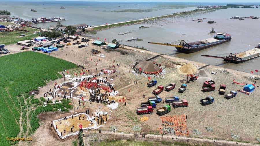
In this aerial drone photo, rescuers work on an embankment to stem the piping effect in Huarong County, central China’s Hunan Province, July 8, 2024. (Xinhua/Chen Zhenhai)
BEIJING, July 8 (Xinhua) — China has mobilized several remote sensing satellites to aid rescue and relief efforts following a dike breach on Friday at Dongting Lake, the country’s second-largest freshwater lake in central Hunan Province.
According to the China Centre For Resources Satellite Data and Application (CRESDA), Gaofen-3 02, Gaofen-3 03, Gaofen-1, and Gaofen-4 satellites have been deployed to provide real-time monitoring of the affected areas.
As of Saturday, satellite imaging has been conducted five times, CRESDA said, adding that data has been swiftly provided to the relevant departments.
On Friday afternoon, a Dongting Lake dike burst in Tuanzhou Township, Huarong County under Hunan’s Yueyang City, triggering flooding in the area. Thousands of rescuers, including firefighters, hydrologists, volunteers and police, have been working tirelessly to safeguard lives and properties.
Satellite images revealed extensive flooding in areas previously identified as meadows or land. They documented a significant reduction in land area and expansion of water surfaces within Dongting Lake, exacerbated by inflows from upstream tributaries surpassing alarm levels.
“We will continue to closely observe the disaster situation in Huarong County and provide remote sensing satellite data and analysis services for flood rescue and relief, disaster assessment and other work,” CRESDA said.
Additionally, many commercial satellites have joined the relief operations. Chang Guang Satellite Technology Co., Ltd., a commercial aerospace enterprise based at Changchun, northeast China’s Jilin Province, has deployed its Jilin-1 Kuanfu 01A satellite.
On Saturday morning, it captured high-resolution images of Dongting Lake shortly after the dike breach. The breach had widened to 226 meters by that time, with extensive local inundation compared to earlier images.
Meanwhile, Smart Satellite Technology Co., Ltd., utilized its SmartSat-X1 satellite to gather detailed data on the disaster area. Beijing Minospace Technology Co., Ltd. also activated its Taijing-4 01 and Taijing-4 03 satellites for the mission.
Taijing-4 03 completed imaging at 10:53 a.m. on Saturday, revealing a disaster zone spanning approximately 12.645 km in diameter and affecting an estimated area exceeding 42 square km. Taijing-4 01 identified potential hazardous risks in some southern areas of Dongting Lake.
The company said they have promptly shared this information with relevant authorities to enhance their situational awareness and response capabilities.
Dongting Lake has historically faced flood challenges. The affected area near Tuanbei Village now covers approximately 50 square km, echoing a similar dike breach incident in 1996.
Hunan Province has endured its heaviest rainfall of the year since June 16, surpassing historical records in some localities.