A couple of months ago, China launched two new satellites for the BeiDou-3 Navigation Satellite System (BDS-3) from the Xichang Satellite Launch Center in southwest China’s Sichuan province.
The two satellites, the 59th and 60th in the family of BeiDou, were the second group of medium Earth orbit (MEO) satellites launched since BDS-3 was formally commissioned to provide satellite navigation services worldwide. They were also the final two satellites for BDS-3.
The BeiDou Navigation Satellite System (BDS) is a project built and operated by China. After many years in development, it has become an important new element of China’s infrastructure, providing high-accuracy, round-the-clock positioning, navigation and timing services to global users in all weathers.

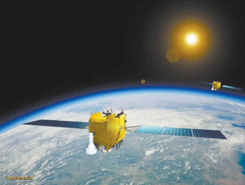
Illustration of the 59th and 60th satellites for the BeiDou-3 Navigation Satellite System (BDS-3). (Photo provided by Chinese Academy of Sciences)
China began to develop its own navigation satellite system in 1994. At the end of 2000, BDS-1 entered service and began providing positioning services in China; in 2012, BDS-2 was completed to provide passive positioning services to the Asia-Pacific region; in 2020, BDS-3 was officially commissioned to provide satellite navigation services around the globe.
One of the keys that enabled BDS-3 to expand from regional to global coverage is that it has realized measurement and communication between satellites through inter-satellite links, or ISL.
The ISL, a bold and innovative approach, refers to a communication line between satellites – a wireless link capable of both data transmission and distance measurement between spacecraft. Based on Chinese domestic ground stations, this technology enables the “out of sight” BeiDou satellites on the far side of the Earth to establish connections with other BeiDou satellites, thereby ensuring seamless communication across the entire constellation.
With the collaboration of over 400 organizations and the efforts of more than 300,000 researchers, BDS represents China’s steady improvements and upgrades in satellite navigation.
In March 2015, China launched the first BDS-3 experimental satellite that involved 70 percent newly developed technologies, maintaining sound operations ever since.
Traditionally, the proportion of new technologies used in satellites does not exceed 30 percent. How was this satellite able to push this boundary to 70 percent? Lin Baojun, researcher with the Innovation Academy for Microsatellites of Chinese Academy of Sciences and chief designer of BDS-3, gives the answer.

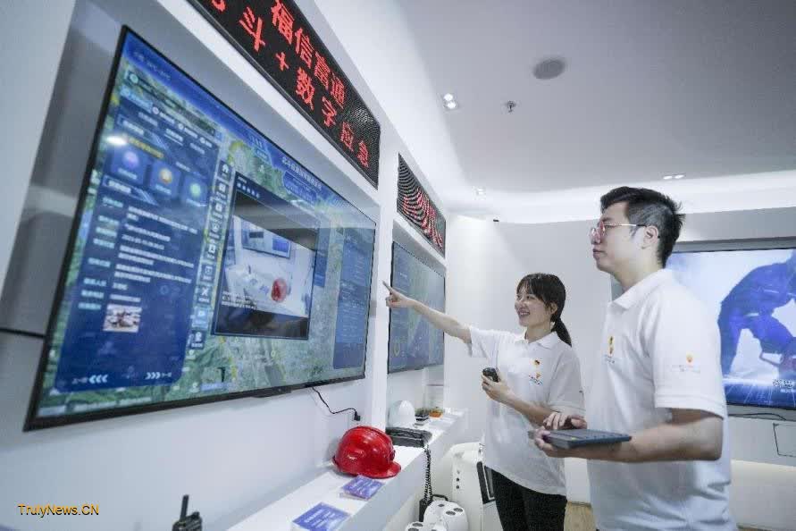
Engineers operate a BDS-enabled digital emergency response system in a tech firm in Fuzhou, southeast China’s Fujian province. (People’s Daily Online/Xie Guiming)
“It usually takes about 10 years to develop a key technology, while a satellite often operates for more than 10 years. This means that by the time a satellite completes its mission, it’s using technologies that are already 20 years old. That’s why it is crucial to adopt an innovative and forward-looking approach in satellite development,” said Lin.
Lin streamlined the satellite’s structure by merging more than 10 subsystems, such as structural components and thermal control, into four major functional chains: electronics, control, structure, and payload. This simplification improved the reliability of the whole system. After repeated selection and testing, Lin and his team adopted mature components and manufacturing processes to ensure the implementation of new technologies, making the satellite technologically advanced.
Sources say that BDS has made breakthroughs in a host of key technologies, achieving the independent development of multiple key components. All the core components of BDS-3 satellites are independently developed and produced by China.
Zheng Xiaodong, a senior engineer with the 54th Research Institute of China Electronics Technology Group Corporation, has been dedicated to developing BDS’ ground system for over 20 years. His team has independently developed the short message communication system unique to BDS-3.
Distinguished from other satellite navigation systems which are limited to passive positioning and can only determine the position of users, BDS-3 can not only know “where I am” but also share “what I’m doing.” When other communication methods break down in case of emergencies like sudden earthquakes or maritime distress, the short message communication services can be indispensable for sending distress signals and saving lives.
To bring satellite messaging to every household, Zheng’s team innovatively came up with the idea of equipping mobile phones with the BDS-3 short message communication function.

A rice transplanter works with the help of the BeiDou Navigation Satellite System (BDS) in Zhaohe village, Xinghua, east China’s Jiangsu province, June 14, 2024. (People’s Daily Online/Zhou Shegen)
“This requires the product to achieve high-power transmission and high-sensitivity reception within an extremely compact design,” Zheng explained.
The team has overcome key technological challenges, such as high-sensitivity rapid acquisition and integrated RF-baseband design, and developed the world’s first low-cost, low-power chip for short message communication at the consumers’ terminal.
Today, the BDS-3 short message communication services have been employed in over 2,500 reservoirs across the country for hydrological monitoring. More than 10 million shared bikes equipped with Chinese independently-produced BDS high-precision positioning chips have been deployed, and mobile phones equipped with short message communication services have been released.
BDS is now deeply integrated into a variety of industries, becoming an important engine for China’s economic and social development.